Why Is Marble Hill in Manhattan? The Bizarre Island Cutoff That Redefined NYC Living
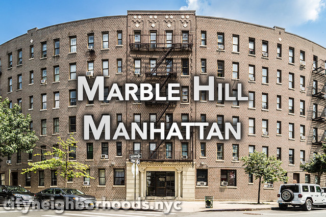
Step off the elevated platform at the 1 train West 225th Street station, and every sensory cue suggests you are standing squarely in the Bronx. Pre-war apartment complexes scale the steep rocky ridges, commercial awnings line Broadway, and the geography underneath your feet is unquestionably part of the North American mainland. Yet the blue street signs, property tax records, and voting ballots tell a completely different story: you are standing in Manhattan.
This geographic paradox is not an administrative glitch. Marble Hill represents one of the most famous NYC geographic anomalies, preserved through a century of stubborn legal wrangling and daring civil engineering. The neighborhood is suddenly in the spotlight again as fresh residential investment touches its transit-rich streets. According to a recent New York YIMBY Report, the launch of a targeted housing lottery at The Danby 170 West 225th Street has renewed citywide interest in how this small slice of New York County jurisdiction thrives north of the water.
📌 Key Takeaways:
- The Cutoff: Marble Hill was detached from Manhattan Island in 1895 by the excavation of the Harlem River Ship Canal, then welded to the Bronx mainland in 1914 when workers filled in Spuyten Duyvil Creek.
- Legal Reality: Despite its physical location, Marble Hill remains part of the Borough of Manhattan and New York County, complete with representation under the Borough President of Manhattan.
- Modern Development: The Danby at 170 West 225th Street represents an expanding wave of transit-oriented housing, bringing rent-stabilized lottery units just steps from the Broadway Bridge NYC corridor.
How Nineteenth-Century Engineering Severed Marble Hill from Manhattan Island
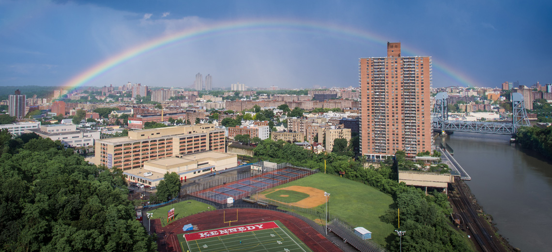
Marble Hill was not always an anomaly. For centuries, it served as the northernmost hill of Manhattan Island, bordered to the north by the winding, shallow waters of Spuyten Duyvil Creek. Dutch settlers and Native Americans crossed the creek at King's Bridge, the earliest land crossing connecting Manhattan to Westchester County. The rocky prominence earned its name from the underlying Inwood marble deposits, quarried extensively during early city expansion.
The trouble began with commercial navigation. In the late nineteenth century, cargo ships seeking a shortcut between the Hudson River and Long Island Sound had to navigate the treacherous, looping shallows of Spuyten Duyvil. Navigating around the tip of the island was inefficient and slow. The U.S. Army Corps of Engineers drafted an ambitious solution: slice a deep, straight channel through the bedrock south of Marble Hill.
Completed in 1895, the Harlem River Ship Canal effectively carved Marble Hill away from the rest of Manhattan. Overnight, the quiet residential hill became an artificial island floating between the old creek to its north and the new deep-water shipping channel to its south. For nearly two decades, residents lived on an isolated patch of land bounded entirely by tidal currents, reachable only by timber footbridges.
Filling Spuyten Duyvil Creek and the Land Bridge to The Bronx
The island era did not last. As shipping traffic surged through the canal, the stagnant loop of original creek bed grew obsolete. It gathered silt, trapped urban runoff, and hindered northern industrial growth. Urban planners decided that leaving an open ditch behind Marble Hill was both a health hazard and a barrier to railway expansion.
Between 1913 and 1914, city contractors filled Spuyten Duyvil Creek using rock and soil excavated from subway tunnels and grand Manhattan construction sites. The ancient riverbed vanished beneath millions of tons of earth, connecting Marble Hill permanently to the Bronx border. The geographic transformation was complete: Marble Hill was physically tethered to the mainland, while the open water of the Harlem River separated it from Manhattan.
The Bronx quickly attempted to annex the neighborhood. Local Bronx politicians argued that municipal logic demanded contiguous borders. Marble Hill residents pushed back fiercely. They cited historical allegiance, property value stability, and political identity. In 1939, a New York State Supreme Court decision confirmed that no piece of a county could be transferred without an explicit legislative act or local referendum. Marble Hill had been chartered as New York County, and New York County it would stay.
Timeline: The Physical and Legal Evolution of Marble Hill
Tracking the shifting status of Marble Hill reveals how civil infrastructure can permanently distort municipal maps without breaking legal bonds.
| Time Period | Physical or Legal Action | Modern Administrative Consequence |
|---|---|---|
| Pre-1895 | Northern tip of Manhattan Island, bounded by Spuyten Duyvil Creek. | Original New York County boundaries established across natural landmass. |
| 1895 | Harlem River Ship Canal opened by U.S. Army Corps of Engineers. | Neighborhood turned into an island severed from Manhattan mainland. |
| 1913, 1914 | Old Spuyten Duyvil riverbed filled in with excavation debris. | Neighborhood fused to the mainland, bordering Kingsbridge in The Bronx. |
| 1939, 1984 | Court rulings and statutory affirmations settle border disputes. | Confirmed jurisdiction under Manhattan Borough President and New York County. |
| Present Era | Transit-oriented infill developments (e.g., The Danby at 170 W 225th St). | Integrated urban hub blending Bronx retail corridors with Manhattan civic governance. |
Jurisdictional Quags: Fire, Mail, Courts, and Politics
Daily municipal operations in Marble Hill read like an urban planner's puzzle. Walk around the perimeter, and the jurisdictional boundaries overlap in surprising ways. Because the neighborhood sits on the mainland, emergency services adapt pragmatically.
Primary policing falls to the NYPD 50th Precinct, based in Kingsbridge, even though the precinct belongs to Patrol Borough Bronx. Emergency calls bypass river crossings to ensure response times stay under five minutes. Fire suppression operates similarly: FDNY units from the Bronx respond alongside Manhattan Engine Company 95, crossing the Broadway Bridge when conditions permit.
Civic life is firmly anchored to downtown Manhattan. Marble Hill residents report for jury duty at the New York County Supreme Court on Centre Street, commuting over ten miles past Central Park. When local residents vote, their district tallies flow to Manhattan results. They cast ballots for the Borough President of Manhattan and city council seats rooted in Upper Manhattan. Even postal routing brings quirkiness: residential addresses carry a Bronx ZIP code (10463), yet standard legal documents demand "New York, NY" as the municipality.
The Danby and Infill Development at 170 West 225th Street
While urban historians treat the neighborhood as a geographic curiosity, developers view it through a pragmatic lens: high transit accessibility paired with competitive land pricing. The latest landmark project along the Broadway corridor is The Danby at 170 West 225th Street. Rising near the commercial crossroads of Broadway and Exterior Street, this modern multi-family development brings needed density directly to the neighborhood's retail core.
The Marble Hill housing lottery launched for The Danby offers rent-stabilized units directed at households earning between 70% and 130% of the Area Median Income. Because the project sits within New York County jurisdiction, it operates under Manhattan housing criteria while offering rents significantly lower than typical Midtown or Lower Manhattan averages.
Projects like The Danby represent a broader shift. Developers are capitalizing on parcels adjacent to the major transit arteries, replacing low-slung industrial structures with energy-efficient residential buildings. For working commuters, winning a housing lottery spot here combines mainland roominess with a direct subway connection south.
Transit Connectivity: Broadway Bridge, the 1 Train, and Metro-North
The neighborhood's enduring real estate appeal boils down to transportation infrastructure. Unlike sprawling suburban pockets, Marble Hill is exceptionally connected.
The central artery is the Broadway Bridge NYC, a heavy double-deck vertical lift bridge that carries both vehicular traffic on U.S. Route 9 and the elevated tracks of the IRT Broadway, Seventh Avenue Line. Commuters boarding the 1 train West 225th Street station reach Columbia University in roughly 20 minutes and Midtown Manhattan in roughly 40 minutes.
A few blocks east sits the Marble Hill Metro-North Station on the Hudson Line. The station offers express-level regional mobility, delivering riders to Grand Central Terminal in roughly 22 minutes, or north toward Westchester County and the Hudson Valley. This dual-rail setup makes the neighborhood a vital northern interchange, bridging the gap between outer-borough living and central business district access.
Frequently Asked Questions (FAQ)
Q1: Why didn't New York City just give Marble Hill to The Bronx?
A1: When the Spuyten Duyvil creek bed was filled in 1914, Marble Hill residents resisted annexation, preferring the political cachet, school districts, and legal continuity of Manhattan. A 1939 legal test determined that changing county borders required state legislative intervention, which never gathered enough political support to pass.
Q2: Do residents of Marble Hill pay Manhattan or Bronx property taxes?
A2: Property owners pay taxes to the City of New York under the jurisdiction of New York County (Manhattan). Assessments, deed recordings, and tax liens are processed through Manhattan municipal offices rather than the Bronx County Clerk.
Q3: How does the housing lottery at The Danby work for local applicants?
A3: Units at The Danby 170 West 225th Street are processed through the NYC Housing Connect portal. Applicants must meet specific household income bands (ranging from 70% to 130% AMI). Community board preferences typically apply to residents of the designated local Manhattan community board district.
Marble Hill's Dual Identity in Modern New York
Marble Hill has spent more than a century ignoring neat cartographic boundaries. Its streetscape combines Bronx commerce with Manhattan institutional governance, sustained by a transit network that links the Hudson Valley to Lower Manhattan. As developments like The Danby reshape West 225th Street, this mainland outpost continues to prove that in New York City, history and infrastructure dictate daily life far more than simple lines on a map.
